2025 Edition Out Now! A Daily Necessity for Saltwater Commerce and Recreation. High and Low Tides for 2 months are in view at the same time. Time and Height Corrections for all points within a Tide District are printed...
2025 Tide Tables & Dot's Fishing Guide-San Francisco
$5.95
2025 Edition Out Now! A Daily Necessity for Saltwater Commerce and Recreation. High and Low Tides for 2 months are in view at the same time. Time and Height Corrections for all points within a Tide District are printed...
2025 Edition Out Now! A Daily Necessity for Saltwater Commerce and Recreation. High and Low Tides for 2 months are in view at the same time. Time and Height Corrections for all points within a Tide District are printed...
2025 Edition Out Now! A Daily Necessity for Saltwater Commerce and Recreation. High and Low Tides for 2 months are in view at the same time. Time and Height Corrections for all points within a Tide District are printed...
2025 Tide Tables: West Coast of North America Including the Hawaiian Islands
$19.95
2025 West Coast of North America (including the Hawaiian Islands) Tide Tables. Contains full predictions for 59 reference ports and differences and other constants for more than 1,285 stations in North America, South America, and the Hawaiian Islands. It also...
The 2025 Ultimate Sailing Calendar
Featuring twelve months of captivating images from the world of yacht racing, presented in our signature 18 by 24-inch format, this calendar is sure to delight.
Waggoner Cruising Guide is the number one purchased guidebook by recreational boaters seeking detailed information about marinas, anchorages, and waterways of the Pacific Northwest. Boaters will find over 300 maps and dock diagrams for easy reference; descriptions and amenities for...
For Use with the Canadian Current Atlas If you use the Canadian Hydrographic Service Canadian Atlas of Tidal Currents -Volume 3, then you need the 2024 Waggoner / Ports and Passes Current Atlas Tables. This handy publication directs the user...
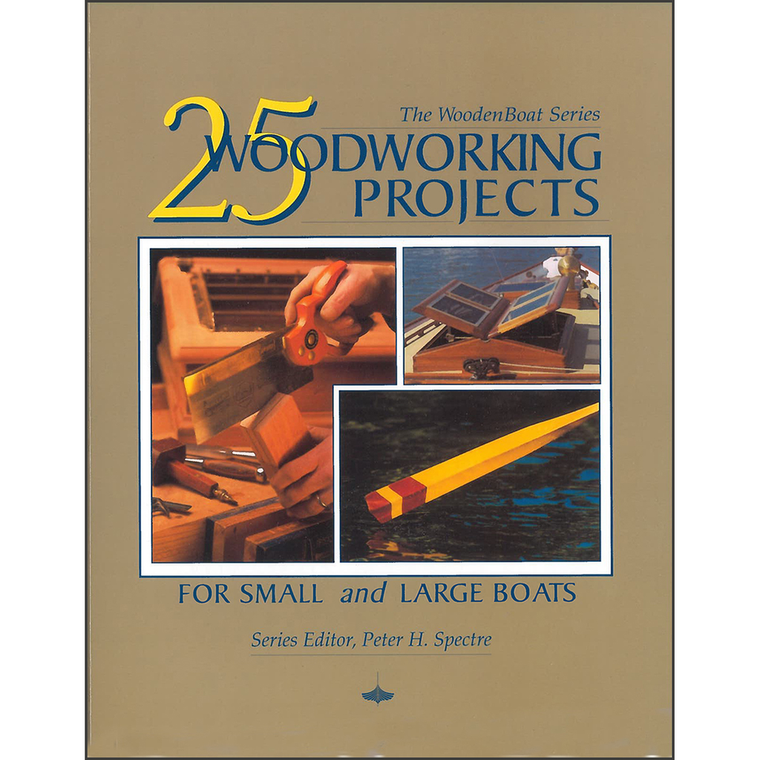
By Peter Spectre (editor)For Small and Large Boats Every project was written by people who have actually made what they are writing about. With plenty of photos and drawings, the step-by-step processes described will help ensure each project’s success as...
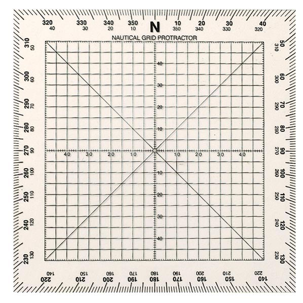
Sometimes referred to as a Douglas protractor, the Square Protractor is best suited for rapid plotting of courses and bearings in a confined space. Overview Suitable for plotting courses and bearings on land or sea. Notations can be made directly...
by Helen D. Nienhueser and John Wolfe Since 1972, 55 Ways has been the most useful guidebook available for discovering Southcentral Alaska. This completely revised fifth edition features seven all-new, comprehensive trips and 18 new side routes. Whether you are...
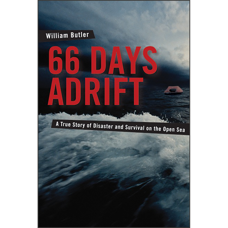
66 Days Adrift: A True Story of Disaster and Survival on the Open Sea
$19.00
By William Butler A Powerful Account of Struggle and Survival at Sea The lure of paradise was unmistakable, and Bill Butler was on a quest to find it with his wife Simonne – riding the Pacific currents on their sloop...
Our straight pattern navigational dividers are made with brass arms and polished stainless steel tips. They are beautiful and functional at the same time. Overview Choose from 7- or 8-inch-long models. Brass handles. Tapered sides and polished stainless steel tips....
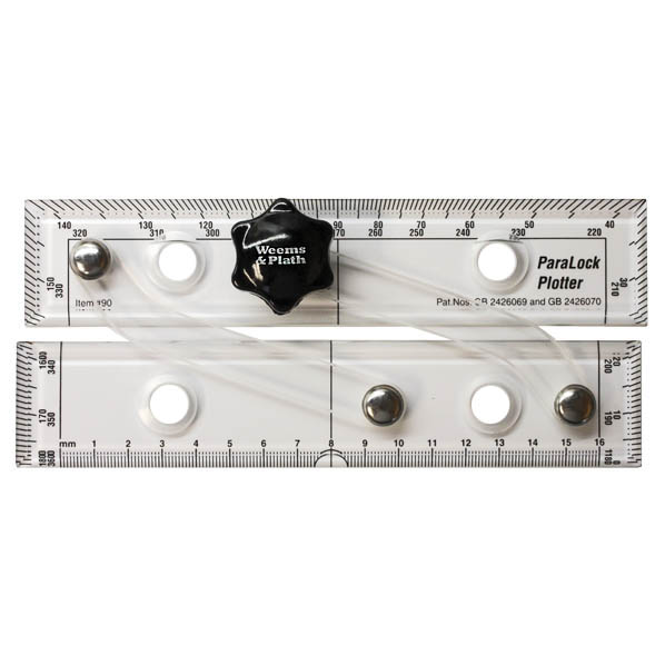
#90 Weems & Plath The GPS Plotter is a GPS chart plotter that provides a straightforward and effective interface between a GPS and a paper chart. Overview Sturdy, clear acrylic for maximum chart visibility. Graduations for use as protractor to...
Our straight pattern navigational dividers are made with brass arms and polished stainless steel tips. They are beautiful and functional at the same time. Overview Choose from 7- or 8-inch-long models. Brass handles. Tapered sides and polished stainless steel tips....
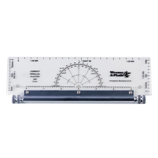
#60 Weems & Plath This compact GPS parallel rule is particularly suited for use on modern small chart tables. Overview Smaller version of our 120 rolling plotter. Plotter is mounted on marine aluminum roller assembly. Distance scales at 1 to...
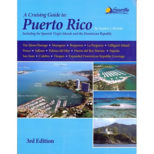
A Cruising Guide to Puerto Rico, 3rd Ed including the Spanish Virgin Islands and the north coast ports of the Dominican Republic: is the most comprehensive guide ever written for Puerto Rico. Its 53 detailed, full-color charts contain extremely...
A Cruising Guide to Puerto Rico: Including the Spanish Virgin Islands, and the Dominican Republic North Coast
Sold Out$35.95
A Cruising Guide to Puerto Rico, 3rd Ed including the Spanish Virgin Islands and the north coast ports of the Dominican Republic: is the most comprehensive guide ever written for Puerto Rico. Its 53 detailed, full-color charts contain extremely accurate...
A Cruising Guide to Puget Sound and the San Juan Islands: Olympia to Port Angeles
$90.00
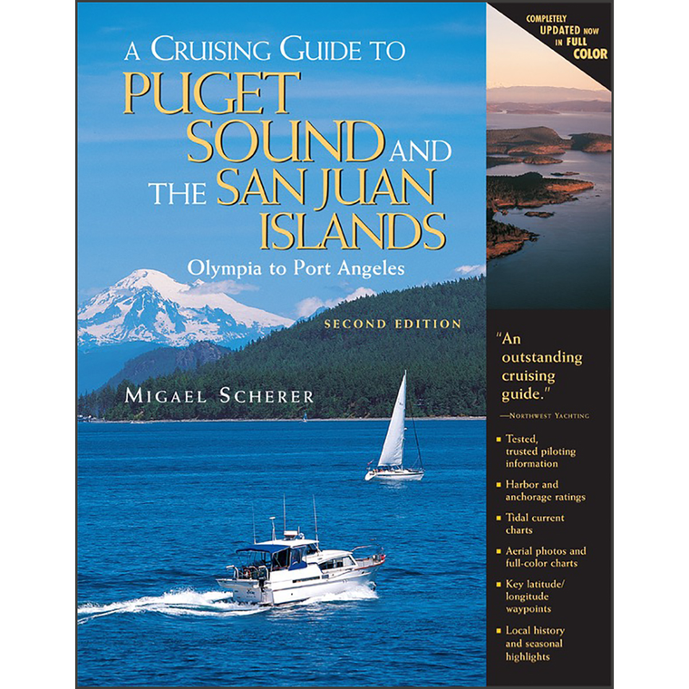
By Migael M. SchererA Cruising Guide to Puget Sound and the San Juan Islands has earned an outstanding reputation for the accuracy of its piloting instructions, the clarity of its writing, and the high quality of its information. This second...