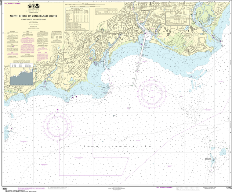
NOAA Chart 12369: North Shore of Long Island Sound - Straitatford to Sherwood Point
$23.75
The chart you are viewing is NOT updated weekly and does NOT include all of the latest Notice to Mariners corrections. Region: Northeast Atlantic Latest Edition: 27 Ed. (1-Nov-2014) Last Correction: 30-Jul-2019 Cleared Through: NTM 47/2019...
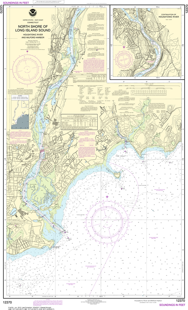
NOAA Chart 12370: North Shore of Long Island Sound - Housatonic River and Milford Harbor
$23.75
The chart you are viewing is NOT updated weekly and does NOT include all of the latest Notice to Mariners corrections. Region: Northeast Atlantic Latest Edition: 21 Ed. (1-Jun-2012) Last Correction: 30-Jul-2019 Cleared Through: NTM 47/2019...
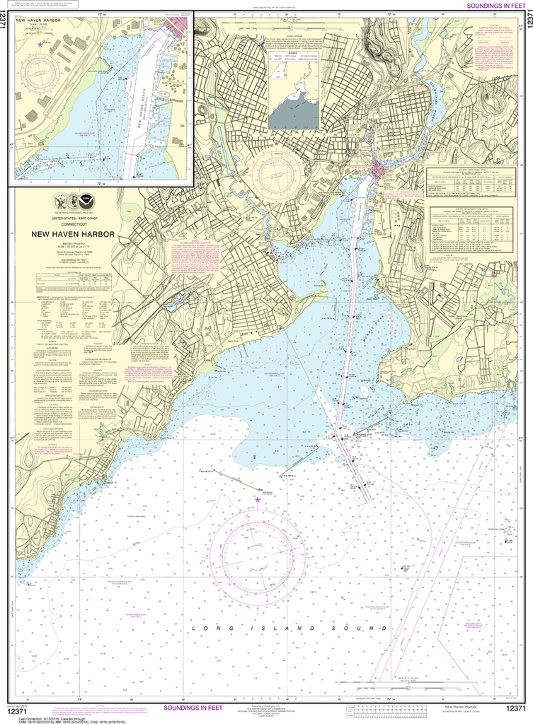
NOAA Chart 12371: New Haven Harbor, New Haven Harbor (Inset)
$23.75
The chart you are viewing is NOT updated weekly and does NOT include all of the latest Notice to Mariners corrections. Region: Northeast Atlantic Latest Edition: 25 Ed. (1-Sep-2012) Last Correction: 6-Sep-2019 Cleared Through: NTM 47/2019...
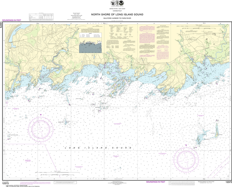
NOAA Chart 12373: North Shore of Long Island Sound - Guilford Harbor to Farm River
$23.75
The chart you are viewing is NOT updated weekly and does NOT include all of the latest Notice to Mariners corrections. Region: Northeast Atlantic Latest Edition: 17 Ed. (1-Apr-2019) Last Correction: 6-Sep-2019 Cleared Through: NTM 47/2019...
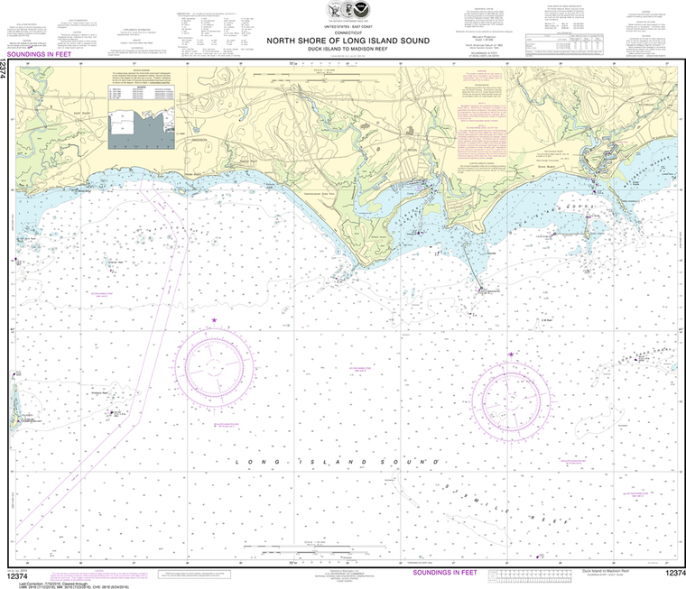
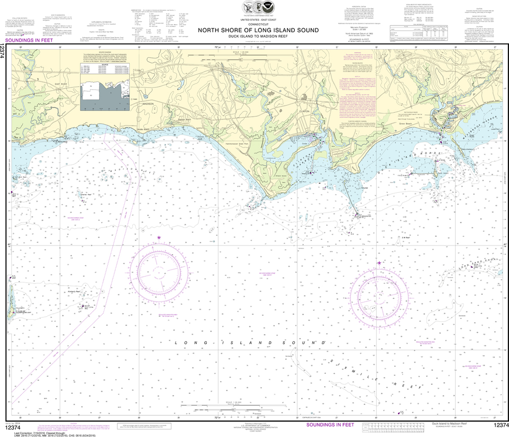
NOAA Chart 12374: North Shore of Long Island - Sound Duck Island to Madison Reef
$23.75
The chart you are viewing is NOT updated weekly and does NOT include all of the latest Notice to Mariners corrections. Region: Northeast Atlantic Latest Edition: 16 Ed. (1-Feb-2019) Last Correction: 25-Nov-2019 Cleared Through: NTM 47/2019...
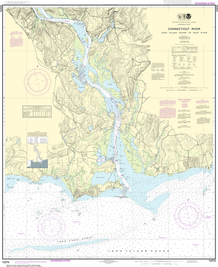
NOAA Chart 12375: Connecticut River - Long lsland Sound to Deep River
$23.75
The chart you are viewing is NOT updated weekly and does NOT include all of the latest Notice to Mariners corrections. Region: Northeast Atlantic Latest Edition: 23 Ed. (1-Apr-2019) Last Correction: 25-Nov-2019 Cleared Through: NTM 47/2019...
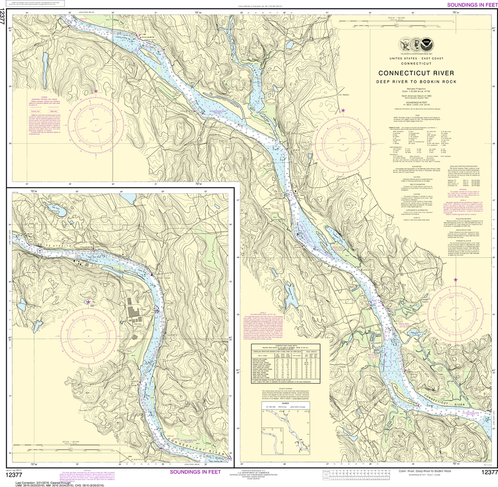
NOAA Chart 12377: Connecticut River - Deep River to Bodkin Rock
$23.75
The chart you are viewing is NOT updated weekly and does NOT include all of the latest Notice to Mariners corrections. Region: Northeast Atlantic Latest Edition: 15 Ed. (1-Sep-2012) Last Correction: 1-Oct-2019 Cleared Through: NTM 47/2019...
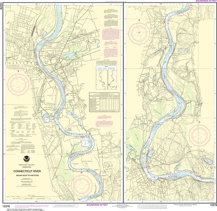
NOAA Chart 12378: Connecticut River - Bodkin Rock to Hartford
$23.75
The chart you are viewing is NOT updated weekly and does NOT include all of the latest Notice to Mariners corrections. Region: Northeast Atlantic Latest Edition: 15 Ed. (1-Feb-2012) Last Correction: 1-Oct-2019 Cleared Through: NTM 47/2019...
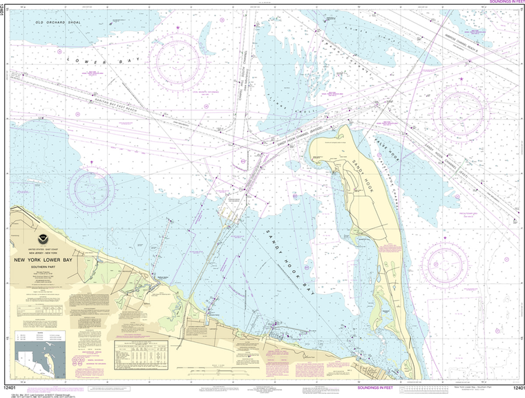
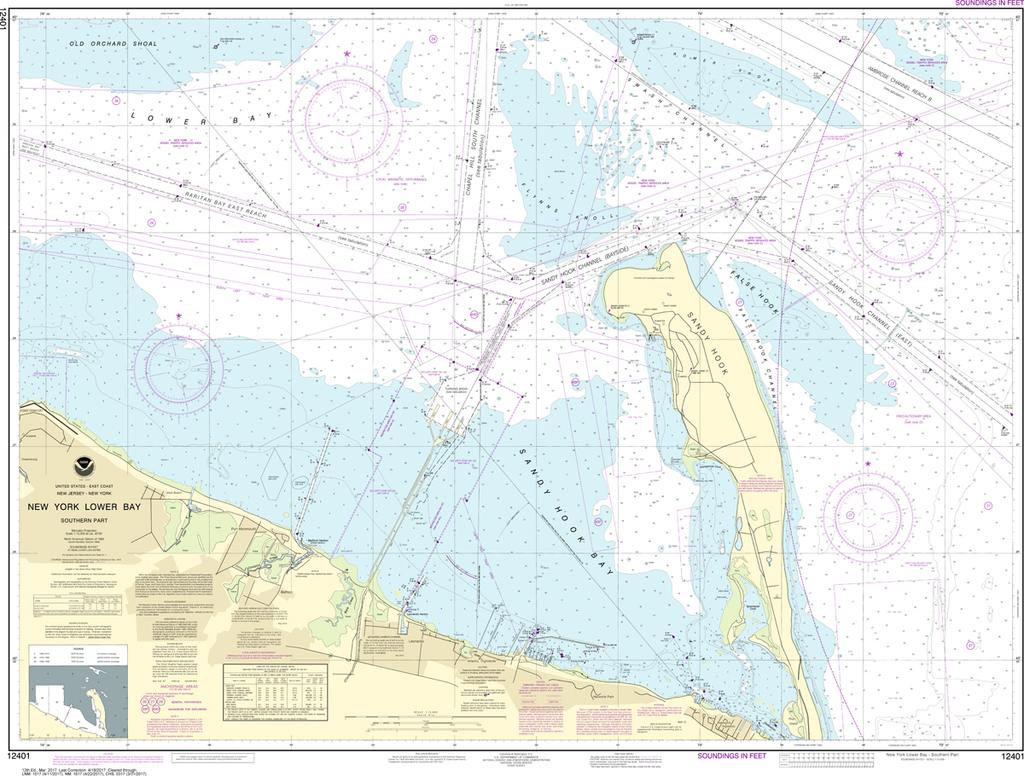
NOAA Chart 12401: New York Lower Bay - Southern Part
$23.75
The chart you are viewing is NOT updated weekly and does NOT include all of the latest Notice to Mariners corrections. Region: Northeast Atlantic Paper Size: 50" x 36" Chart Image Size: 35" x 46" Scale:...
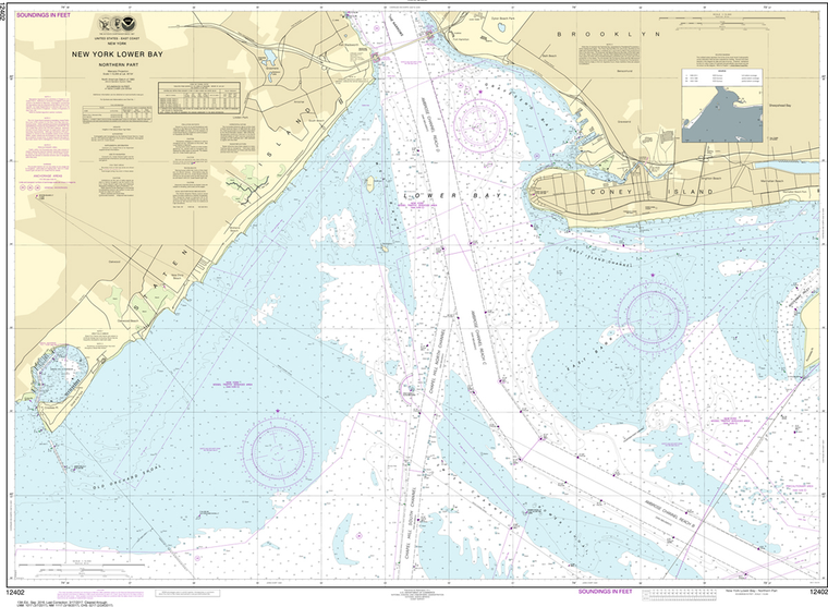
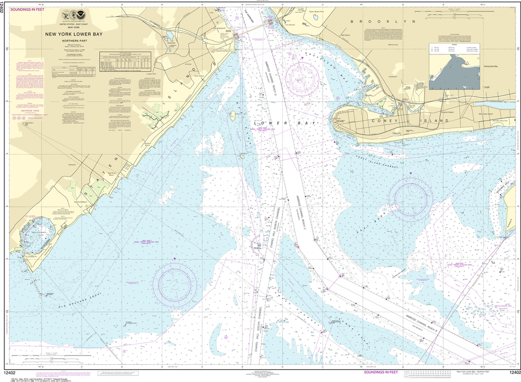
NOAA Chart 12402: New York Lower Bay - Northern Part
$23.75
The chart you are viewing is NOT updated weekly and does NOT include all of the latest Notice to Mariners corrections. Region: Northeast Atlantic Paper Size: 52" x 36" Chart Image Size: 35" x 48" Scale: 1:15,000 Captain's...
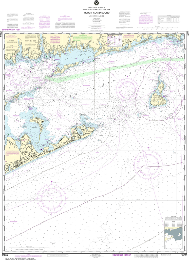
NOAA Chart 13205: Block Island Sound and Approaches
$23.75
The chart you are viewing is NOT updated weekly and does NOT include all of the latest Notice to Mariners corrections. Region: Northeast Atlantic Latest Edition: 41 Ed. (1-Feb-2017) Last Correction: 6-Sep-2019 Cleared Through: NTM 47/2019 (23-Nov-2019)...
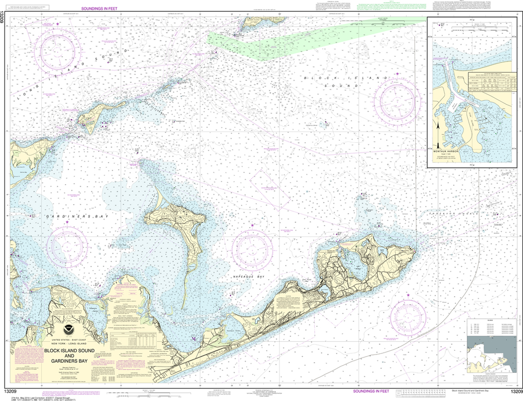
NOAA Chart 13209: Block Island Sound and Gardiners Bay, Montauk Harbor
$23.75
The chart you are viewing is NOT updated weekly and does NOT include all of the latest Notice to Mariners corrections. Region: Northeast Atlantic Latest Edition: 28 Ed. (1-Aug-2017) Last Correction: 6-Sep-2019 Cleared Through: NTM 47/2019 (23-Nov-2019)...
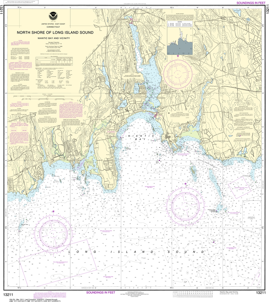
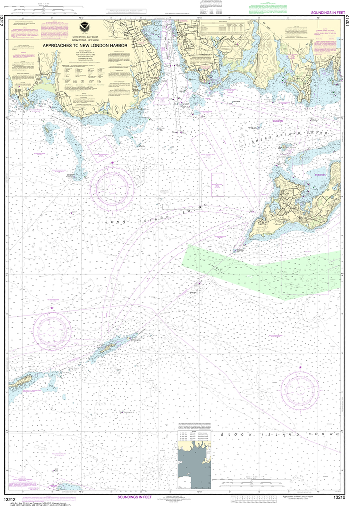
NOAA Chart 13211: North Shore of Long Island Sound - Niantic Bay and Vicinity
$23.75
The chart you are viewing is NOT updated weekly and does NOT include all of the latest Notice to Mariners corrections. Region: Northeast Atlantic Paper Size: 36" x 36" Chart Image Size: 33" x 29" Scale: 1:20,000 Captain's...
The chart you are viewing is NOT updated weekly and does NOT include all of the latest Notice to Mariners corrections. Region: Northeast Atlantic Paper Size: 51" x 36" Chart Image Size: 47" x 33" Scale: 1:20,000 Captain's...
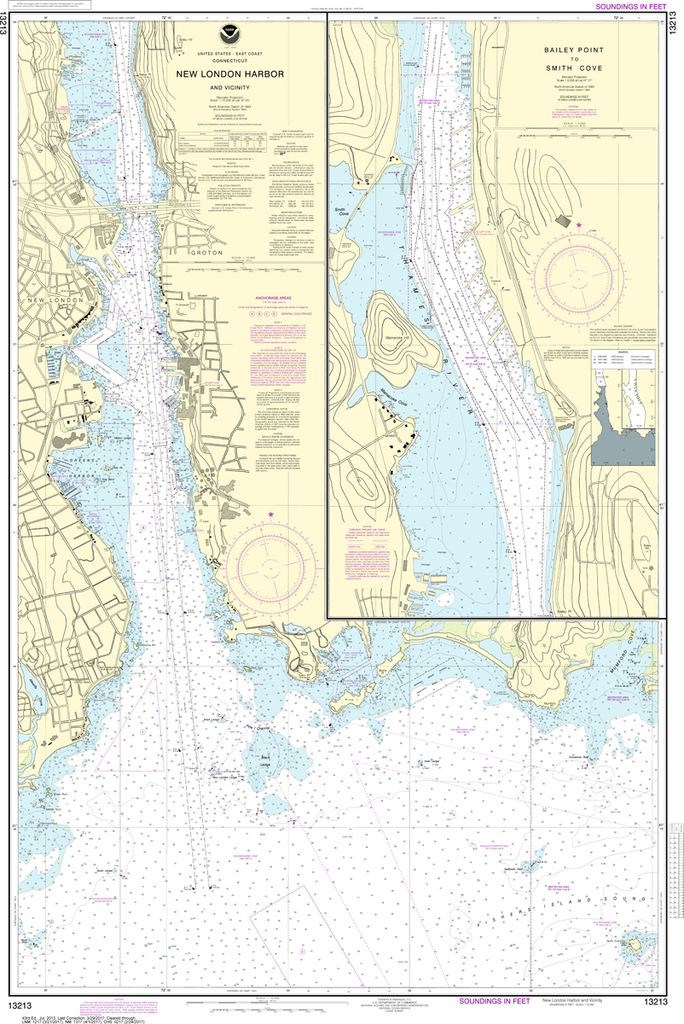
NOAA Chart 13213: New London Harbor and Vicinity, Bailey Point to Smith Cove
$23.75
The chart you are viewing is NOT updated weekly and does NOT include all of the latest Notice to Mariners corrections. Region: Northeast Atlantic Paper Size: 50" x 36" Chart Image Size: 46" x 31" Scale: 1:10,000 Captain's...
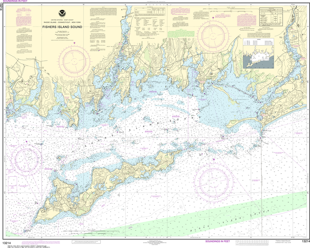
The chart you are viewing is NOT updated weekly and does NOT include all of the latest Notice to Mariners corrections. Region: Northeast Atlantic Paper Size: 44" x 36" Chart Image Size: 33" x 41" Scale: 1:20,000...
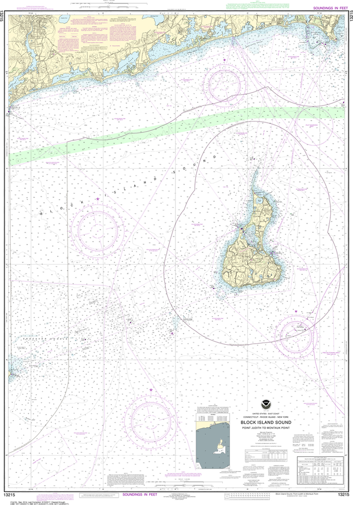
NOAA Chart 13215: Block Island Sound - Point Judith to Montauk Point
$23.75
The chart you are viewing is NOT updated weekly and does NOT include all of the latest Notice to Mariners corrections. Region: Northeast Atlantic Latest Edition: 21 Ed. (1-Sep-2014) Last Correction: 28-May-2019 Cleared Through: NTM 47/2019 (23-Nov-2019)...
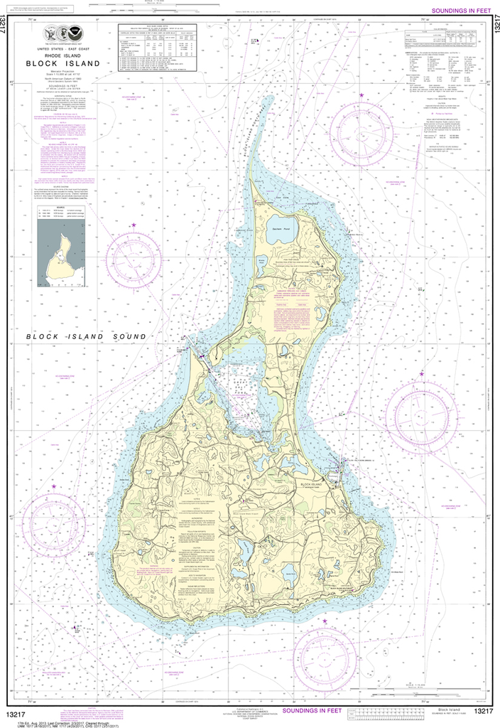
The chart you are viewing is NOT updated weekly and does NOT include all of the latest Notice to Mariners corrections. Region: Northeast Atlantic Latest Edition: 17 Ed. (1-Aug-2013) Last Correction: 28-Nov-2018 Cleared Through: NTM 47/2019 (23-Nov-2019)...