The chart you are viewing is NOT updated weekly and does NOT include all the of the latest Notice to Mariners corrections.
Region: Mid-Atlantic Paper Size: 50" x 36" Chart Image Size: 46" x 33" Scale: 1:80,000
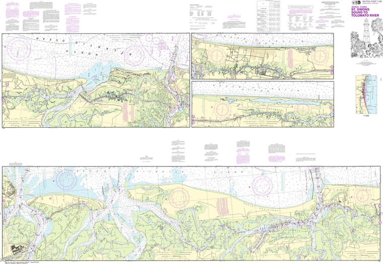
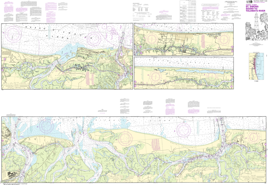
NOAA Chart 11489: Intracoastal Waterway - St. Simons Sound to Tolomato River
$23.75
The chart you are viewing is NOT updated weekly and does NOT include all of the latest Notice to Mariners corrections.
Region: Mid-Atlantic Paper Size: 62" x 42" Chart Image Size: 41" x 59" Scale: 1:40,000
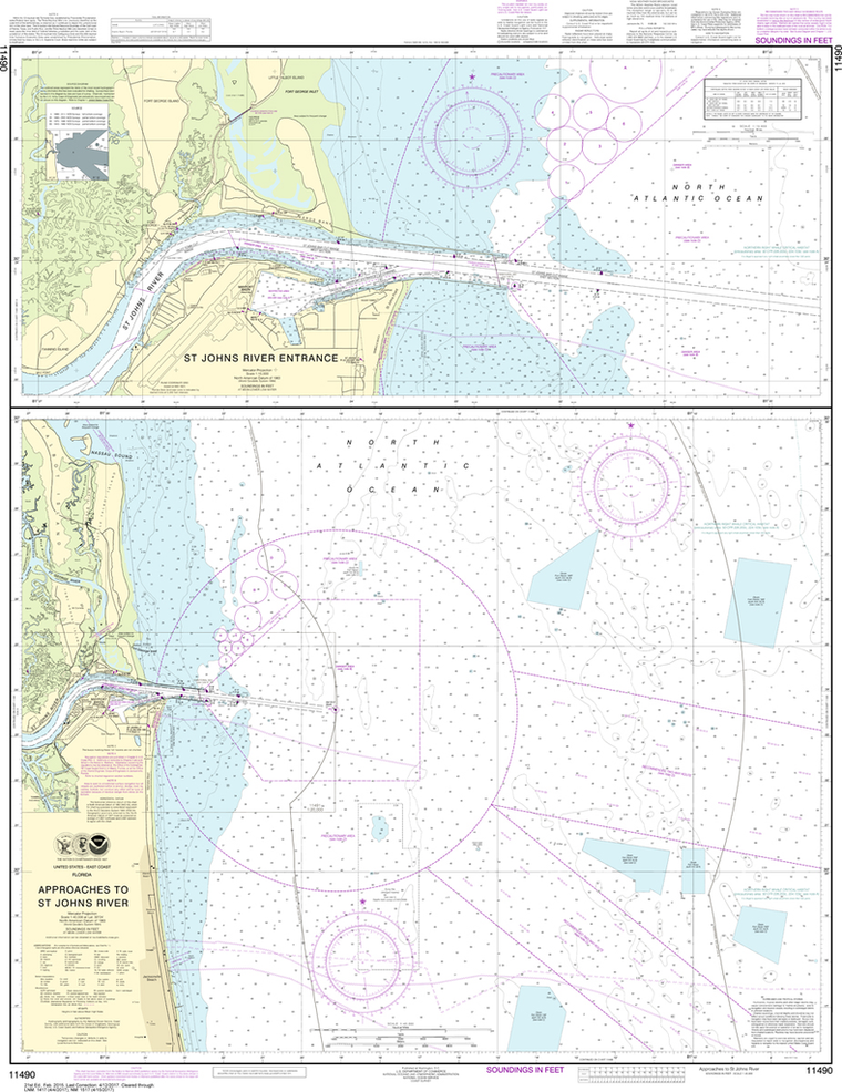
NOAA Chart 11490: Approaches to St. Johns River, St. Johns River Entrance
$23.75
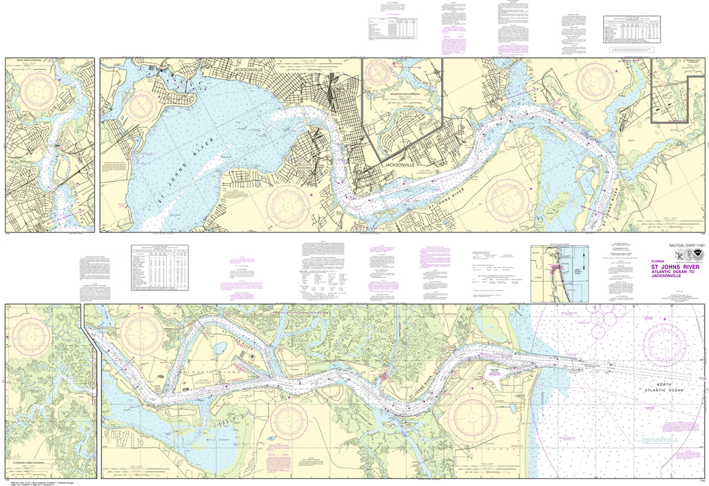
The chart you are viewing is NOT updated weekly and does NOT include all the of the latest Notice to Mariners corrections.
Region: Mid-Atlantic Paper Size: 47" x 36" Chart Image Size: 44" x 34" Scale: 1:40,000
NOAA Chart 11491: St. Johns River - Atlantic Ocean to Jacksonville
$23.75
The chart you are viewing is NOT updated weekly and does NOT include all of the latest Notice to Mariners corrections.
Region: Mid-Atlantic Paper Size: 62" x 42" Chart Image Size: 40" x 59" Scale: 1:20,000
NOAA Chart 11492: St. Johns River - Jacksonville to Racy Point
$23.75
Region: Mid-Atlantic Paper Size: 38" x 36" Chart Image Size: 35" x 35" Scale: 1:40,000 Captain's Nautical Supplies is a Print-on-Demand nautical chart dealer for US Waters. All charts are printed up-to-date and corrected to the latest Notice to...
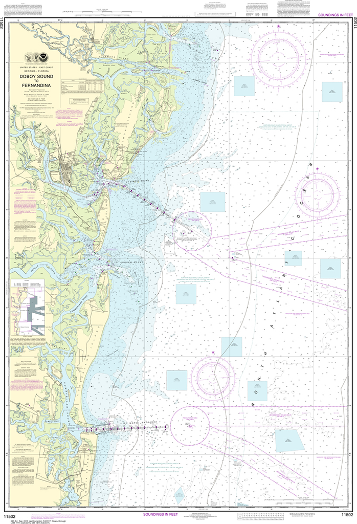
The chart you are viewing is NOT updated weekly and does NOT include all the of the latest Notice to Mariners corrections.
Region: Mid-Atlantic Paper Size: 52" x 36" Chart Image Size: 49" x 33" Scale: 1:80,000
NOAA Chart 11503: St. Marys Entrance - Cumberland Sound and Kings Bay
$23.75
The chart you are viewing is NOT updated weekly and does NOT include all of the latest Notice to Mariners corrections. Region: Mid-Atlantic Latest Edition: 47 Ed. (1-Feb-2019) Last Correction: 6-Nov-2019 Cleared Through: NTM 47/2019 (23-Nov-2019) ...
NOAA Chart 11504: St. Andrew Sound and Satilla River
$23.75
Region: Mid-Atlantic Paper Size: 50" x 36" Chart Image Size: 34" x 46" Scale: 1:40,000 Captain's Nautical Supplies is a Print-on-Demand nautical chart dealer for US Waters. All charts are printed up-to-date and corrected to the...
The chart you are viewing is NOT updated weekly and does NOT include all of the latest Notice to Mariners corrections. Region: Mid-Atlantic Latest Edition: 5 Ed. (1-Aug-2014) Last Correction: 13-Dec-2019 Cleared Through: NTM 47/2019 (23-Nov-2019) ...
NOAA Chart 11506: St. Simons Sound - Brunswick Harbor and Turtle River
$23.75
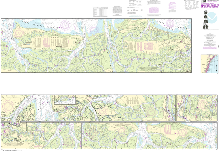
The chart you are viewing is NOT updated weekly and does NOT include all of the latest Notice to Mariners corrections. Region: Mid-Atlantic Latest Edition: 46 Ed. (1-Aug-2018) Last Correction: 9-Oct-2019 Cleared Through: NTM 47/2019 (23-Nov-2019) ...
NOAA Chart 11507: Intracoastal Waterway - Beaufort River to St. Simons Sound
$23.75
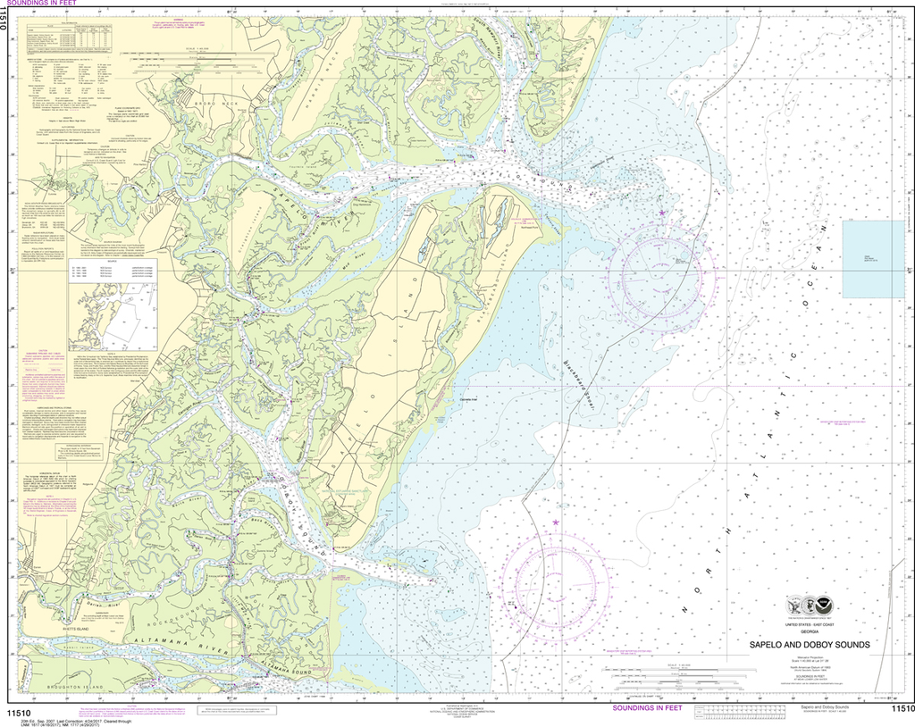
The chart you are viewing is NOT updated weekly and does NOT include all of the latest Notice to Mariners corrections. Region: Mid-Atlantic Latest Edition: 36 Ed. (1-Jun-2015) Last Correction: 13-Dec-2019 Cleared Through: NTM 47/2019 (23-Nov-2019) ...
NOAA Chart 11511: Ossabaw and St. Catherines Sounds
$23.75
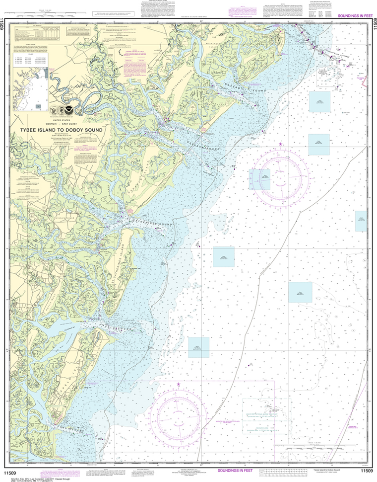
Region: Mid-Atlantic Paper Size: 47" x 36" Chart Image Size: 33" x 43" Scale: 1:40,000 Captain's Nautical Supplies is a Print-on-Demand nautical chart dealer for US Waters. All charts are printed up-to-date and corrected to the...
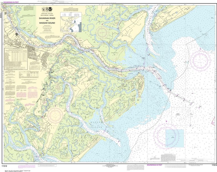
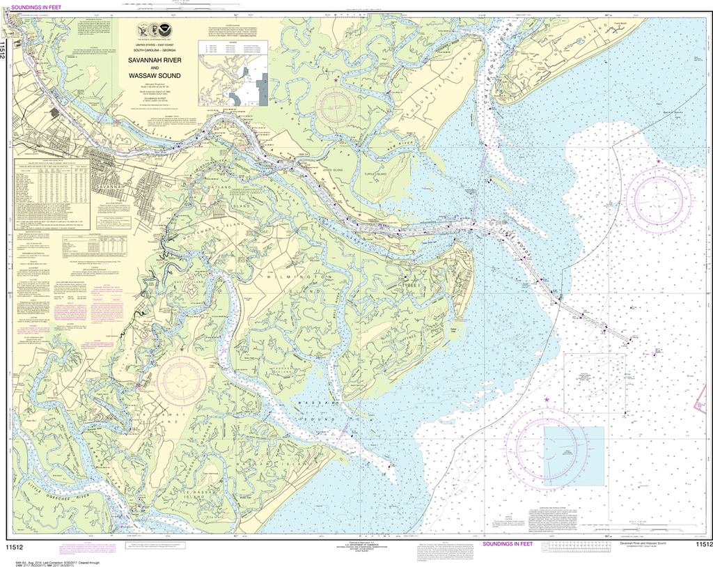
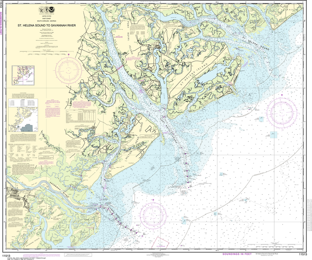
The chart you are viewing is NOT updated weekly and does NOT include all of the latest Notice to Mariners corrections. Region: Mid-Atlantic Latest Edition: 65 Ed. (1-Sep-2017) Last Correction: 13-Dec-2019 Cleared Through: NTM 47/2019 (23-Nov-2019) ...
NOAA Chart 11513: St. Helena Sound to Savannah River
$23.75
The chart you are viewing is NOT updated weekly and does NOT include all of the latest Notice to Mariners corrections. Region: Mid-Atlantic Latest Edition: 29 Ed. (1-Aug-2019) Last Correction: 13-Dec-2019 Cleared Through: NTM 47/2019 (23-Nov-2019) ...
NOAA Chart 11515: Savannah River - Brier Creek to Augusta
$23.75
THIS CHART IS CURRENTLY CANCELED BY NOAA. We know there are many questions about NOAA charts, newest editions and charts being cancelled. The U.S. Office of Coast Survey provides an updated list of all chart updates and the ones being...
NOAA Chart 11516: Port Royal Sound and Inland Passages
$23.75
The chart you are viewing is NOT updated weekly and does NOT include all of the latest Notice to Mariners corrections. Region: Mid-Atlantic Latest Edition: 32 Ed. (1-Dec-2013) Last Correction: 13-Aug-2019 Cleared Through: NTM 47/2019 (23-Nov-2019) ...
Region: Mid-Atlantic Paper Size: 49" x 36" Chart Image Size: 46" x 31" Scale: 1:40,000 Captain's Nautical Supplies is a Print-on-Demand nautical chart dealer for US Waters. All charts are printed up-to-date and corrected to the...
NOAA Chart 11518: Intracoastal Waterway - Casino Creek to Beaufort River
$23.75
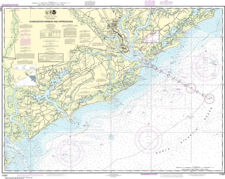
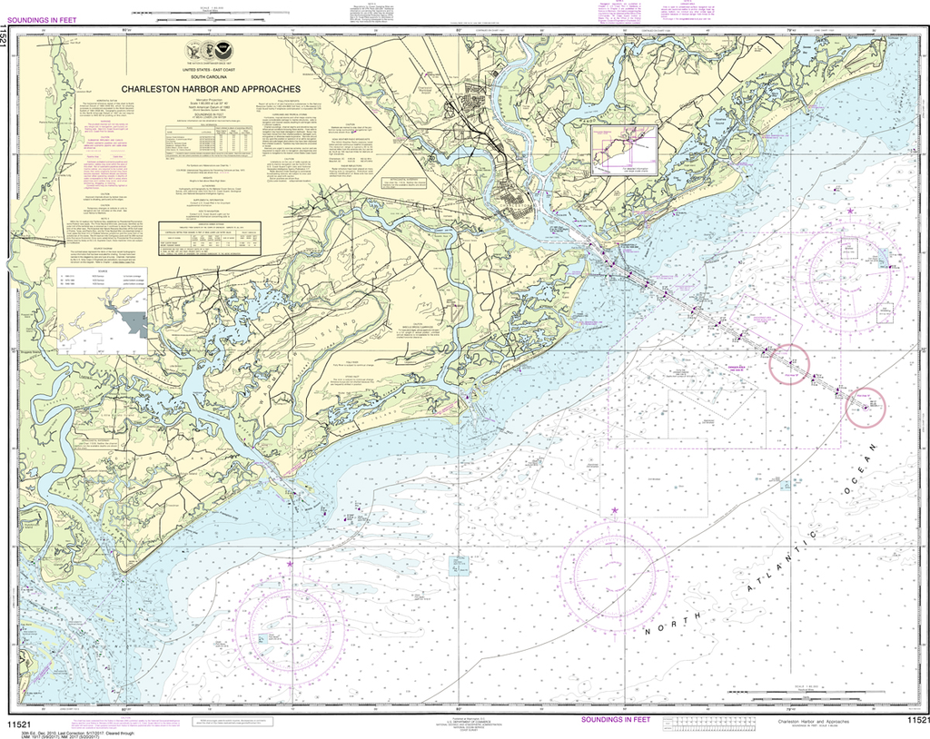
The chart you are viewing is NOT updated weekly and does NOT include all of the latest Notice to Mariners corrections. Region: Mid-Atlantic Latest Edition: 38 Ed. (1-May-2012) Last Correction: 13-Aug-2019 Cleared Through: NTM 47/2019 (23-Nov-2019) ...
NOAA Chart 11521: Charleston Harbor and Approaches
$23.75
The chart you are viewing is NOT updated weekly and does NOT include all of the latest Notice to Mariners corrections. Region: Mid-Atlantic Latest Edition: 32 Ed. (1-Aug-2018) Last Correction: 27-Sep-2019 Cleared Through: NTM 47/2019 (23-Nov-2019) ...